| ItemNo: |
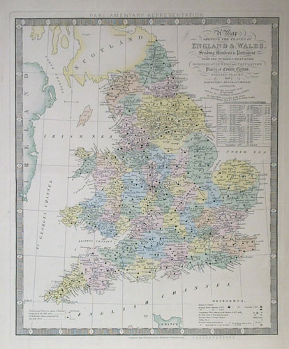
1640 |
| Medium: |
Etching/Engraving |
| Paper: |
Velin |
| Image Size: |
17.75x14.50 |
| Paper Size: |
22.75x17 in. |
| Released: |
1871 |
| Signed: |
Unsigned |
| Reference: |
See notes |
| Ref. No: |
522 |
| Price: |
$350.00
|
|
|
| Shipping: |
|
| TOTAL: |
$360.00
(USA Only) |
| Add to Cart: |
|
Etching is part of the intaglio family (along with engraving, drypoint, mezzotint, and aquatint.) The process is believed to have been invented by Daniel Hopfer (circa 1470-1536) of Augsburg, Germany, who decorated armour in this way, and applied the method to printmaking. Etching soon came to challenge engraving as the most popular printmaking medium. Its great advantage was that, unlike engraving which requires special skill in metalworking, etching is relatively easy to learn for an artist trained in drawing.
The Three Crosses, etching by Rembrandt
Etching prints are generally linear and often contain fine detail and contours. Lines can vary from smooth to sketchy. An etching is opposite of a woodcut in that the raised portions of an etching remain blank while the crevices hold ink. In pure etching, a metal (usually copper, zinc or steel) plate is covered with a waxy or acrylic ground. The artist then draws through the ground with a pointed etching needle. The exposed metal lines are then etched by dipping the plate in a bath of etchant (e.g. nitric acid or ferric chloride). The etchant "bites" into the exposed metal, leaving behind lines in the plate. The remaining ground is then cleaned off the plate, and the printing process is then just the same as for engraving.
[edit] Mezzotint |
